The Last Days in the Rain Shadow
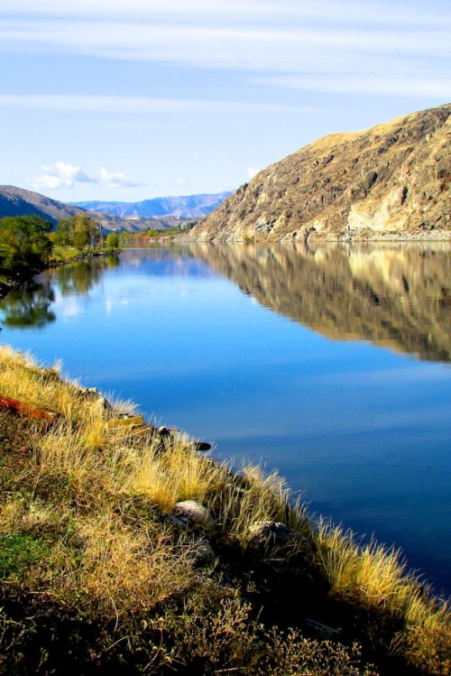
The weight of a winter storm has whisked away the opportunity to further my exploration of the Methow Valley for another season. The fragile thread of concrete that is Highway 20 has crumbled under the piles of snow and biting wind, cutting me off from the expansiveness of this high desert refuge. There, the strange arid landscapes spread out thin and dry from the rain shadow of the North Cascades. Abundance lines the banks of the Methow River: fresh produce, fine wineries, excellent coffee and recreation aplenty. I have found it challenging to move myself beyond the borders of this Nirvana, but recently my curiosity was sufficiently piqued.
As one who called Oregon home for many years prior to my arrival in Washington, I had always claimed the Columbia River by right as an Oregonian. I have explored its reaches from every vantage on the Oregon side. Upon meaningful examination of a map, however, I had to admit that it was much more a Washington river, which did not alter my adoration. I set out to find the Columbia Plateau: my river beyond the Oregon border bend.
Upon my exploration of the flood lands to the East I embarked. The Columbia carved its mighty way, reflective and deep through the sagebrush-spotted hills of brown grass and exposed rock. Bighorn sheep leapt along the upper reaches of its banks, darting with ease over the steep slopes and loose terrain. Once a glacial lake at the southernmost edge of the Cordilleran Ice Sheet, the Columbia River’s geologic origins held a dramatic history that starkly contrasted its now tranquil presentation.
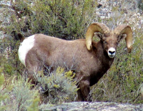 A male bighorn sheep amongst the rocks near the Rock Island Dam on the Columbia River in eastern Washington.
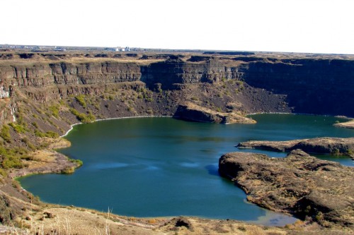 Once the largest waterfall in the world, Dry Falls remains a dramatic monument to its turbulent past.
I had entered the Channelled Scablands, and it felt like Oz. I was in disbelief that I was still in the state of Washington. Between 14,000 and 20,000 years in the past, the landscape had been repeatedly rocked by cataclysmic floods. Ice up to 4,000 feet high scored deep channels into the landscape which would fill with water. The water would become trapped behind enormous walls of ice until the colossal pressure shattered them and sent inconceivable torrents though the valley. It would have been like Armageddon around every dozen years or so.
As I followed the path of the river to the South, I discovered Sun Lakes-Dry Falls State Park. After many miles of flat, unremarkable farmland, it opened up from the earth; this giant gaping chasm that had once been the site of the largest waterfall on the planet. At the time of the Missoula Floods, Dry Falls was four times the size of Niagara Falls, with water speeds of 65 miles per hour and water volume that equaled the combined flows of all the rivers on earth today. The skeleton of the falls is 400 feet high and 3.5 miles long. Now devoid of water, it looms over several saline and freshwater lakes that teem with wildlife.
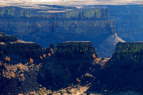 Electric green lichen add contrast to the basalt.
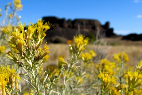 Yellow sagebrush (Artemisia tridentata) flowers.
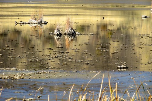 Saline lakes are home to water foul and other wildlife.
After taking in the view from the overlook, I descended into the great ravine and found a place in the center to explore on foot. I felt as though I was in the desert southwest. The air blew warm and dry, and towering rock forms erupted from hills of yellow sagebrush flowers and bunchgrass. The rock itself was unearthly, metallic and strange with glowing green lichen and rusty iron shades.
There I walked in wonder for a long while, the dusty white sand of the trail silencing my steps. In the expansiveness under an impossibly azure sky I breathed and watched the shadows shift. Only 110 crow miles away, my home in Diablo lay saturated in the watery womb of the West.
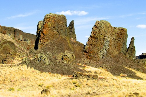 Rock in iron tones creates an unearthly setting as is emerges from the sage and bunchgrass at Sun Lakes-Dry Falls State Park.
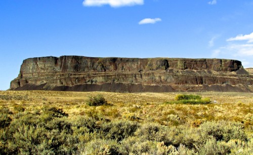 Steamboat Rock along the Banks Lake Reservoir section of the Columbia River
I departed Dry Falls and followed my great river northeast where it formed the 27-mile Banks Lake Reservoir. Steamboat Rock rose like some great ark from the river’s edge. I traveled all the way to the Grand Coulee Dam, its mighty bulk containing the run of the river. The Columbia is one of the most heavily dammed river systems in the world. This realization saddened me. I tried to imagine the days when it ran free and wild with great falls and plentiful salmon fighting their way up its rapids to abundant spawning grounds. I had found her, my river, bound to the will of man.
With a tinge of longing and my curiosity satiated, I made my way back over Highway 20. Through Omak and Okanogan, all the way back to Twisp, I returned to the mountains that held back the rain. I enjoyed one last meal in the Methow before crossing Washington Pass and sinking into the West to wait out the winter until the road to my refuge opens again.
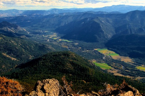 The magical Methow River Valley from the Goat Peak Lookout near Mazama.
Leading photo: The Columbia River flowing deep and reflective near Orondo, WA.All photos by Elissa Kobrin.
Elissa Kobrin is a graduate student in North Cascades Institute and Western Washington University’s M.Ed. program. She is a co-editor of Chattermarks. When not tracking down moose, she is keeping the world safe, one Band-aid at a time.


Elissa, vivid imagery and excellent photos. I hope you find your moose and I look forward to reading about your explorations on the green side now that your Methow connection is cut.
Thank you for the trip :o) Beautiful to read. Beautiful to see. The best part is not having to pack and unpack – but I miss the road.
Beautifully written, Elissa.
That photo that is captioned as Artemisia tridentatat is mis-identified. It definitely is not Artemisia tridentatat, It looks to me like a Chrysothamnus genus possibly Chrysothamnus nauseosus