Park Creek Pass: A Tale of Two Hikes
 It was early August, and time for the end-of-quarter North Cascades backpacking adventure for the new graduate students, collectively called “Cohort 13.” At 12 people, plus two instructors, we exceeded the Park Service’s backcountry limit of 12 hikers per group. So we picked two routes: One party would travel the high road over McAllister Pass and the other would follow the mellower yet equally scenic Bridge Creek Trail. The plan was to meet up about 30 miles later in Stehekin, and then divide again. The following is one perspective from one hiker in the group that went over the pass.
Day 1: The cohort splits at the Rainy Pass parking lot off Highway 20 and heads down the Bridge Creek Trail. Separation anxiety attempts to set in, but the scenery is too captivating. Later, the pain is too great. Ten day’s worth of food, scores of switchbacks. We are broken in and make it, dragging, to McAllister Lake. Midnight lightening storms trigger visions of an electric death, or a ecstatic rave.
Day 2: Subalpine meadows stretch like Oz through McAllister Pass. We’re a little late for a wildflower explosion, but we still spy the indigo gentian and some older chartreuse ribbons of false hellebore. We make it to Bench Creek, with its manzanita mats and forest of spindly snags.
Day 3: Solo hikes to Rainbow Lake. Learn the riddle “Green Glass Door” (“a tree/puppy/moss/apple can go through a green glass door, but a flower/dog/fern/banana can’t,” etc.) which will prove an invaluable tool a month later in Mountain School. It’s a treat to have some time alone, with letters to friends and a screechy pennywhistle. In the evening, we huddle under the group tarp as it hails hard and heavy for five solid minutes. There’s a mini-avalanche, ice the size of Whoppers, into our cozy cookspace, and into David’s bivy sac.
Day 4: Descent into Stehekin, traipsing through where the Rainbow Bridge Fire lived in 2010. The remnants offer a picturesque contrast: Charred snags and standing pines, magenta fireweed coming in like a beautiful weed and offering fixed nitrogen to the altered landscape. What will Stehekin be like, this controversial little National Park inholding? We were just starting to accumulate a backcountry layer of dirt and blood. Could it be too soon to re-enter civilization?
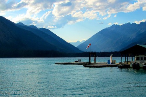 Lake Chelan, with the Stehekin River valley opening toward the sky. Photo by Elissa Kobrin.

Day 5: Potentially yes, had town and culture not tasted of cinnamon rolls bigger than my face and crisp lettuce, of IPA and cherry tomatoes. The cohort reunites. We lay across the bridge to Harlequin camp, laughing and awing over meteors.
Day 6: The entire cohort takes the bus to the end of that old, contested Stehekin Road to High Bridge, where we will soon divide once again and discover our respective paths. Hundreds of tiny western toads cross the Old Wagon Trail, making hiking without imprinting the amphibs with Vibram soles a morbid challenge. Our 13.2 miles begin and, though hard, are a success.
Here, accounts diverge even more between the two groups….choose your own adventure: Elissa’s version! or, Katherine’s version!
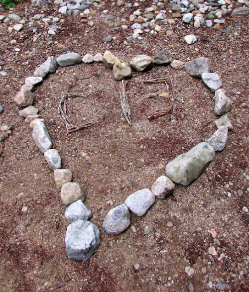
Leading photo: Some naturally-inspired love from one part of C13 to another, near the bridge at Park Creek Camp. Photo by Elissa Kobrin.