Eating Snow: Climate Change, Snowpack and Agriculture Water-Use Policy in the Methow Valley

By Annah Young, graduate student in the Institute’s 15th cohort.
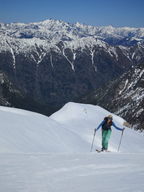
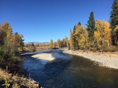
I wedged myself between two boulders on the summit of Silver Star Mountain in Okanagan County, Washington and peered out over the North Cascades range. It was May 1, 2016. Mount Baker was crystal clear some 100 miles to the west across the snow cover peaks. The mountains were shimmering, almost blindingly so, in all directions with miles and miles of snowfields. The day was hot, almost 60 degrees in the sun at an elevation of 8,875 feet. Our ski boots were standing on a snowpack of over 8 feet deep I was trying to fathom the amount of frozen water surrounding me. Looking to the east I saw the Methow Valley and Okanagan County expanding into the horizon and tried to imagine the journey that the water molecules beneath my feet will make, providing habitat for migrating steelhead trout, nourishing Cottonwoods, and irrigating crops that become food to nourish the people. I chugged the last bit of water that was in my Nalgene, filled it to the brim with snow, stuffed the bottle in my pack and skied down 5,000 feet of glorious spring corn snow.
Snowpack in the North Cascades has declined between 20% and 40% since 1950 (Stoelinda, Albright, Mass, 2009, p. 1). Snowpack in the mountains is stored water that provides life to all organisms including humans by irrigating and growing the food we eat. Snowpack is declining due to natural climate fluctuations and anthropogenic global warming.
The magnitudes of stakeholders, both human and non-human, that depend on Methow River flows are vast and the challenges are complicated. The Methow basin relies heavily on winter snowpack and surface water extraction because of the region’s dry climate.
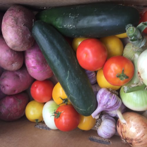
My natural history project seeks to hone in on agriculture use and policy, while recognizing that the scope of water use goes far beyond just food production. What is the connection between the frozen alpine thousands of feet above us to the food we grow for our community? And, if this essential source of life is dwindling, what are we doing to adapt to these changes?
Methow farmers who rely on surface water to irrigate crops are faced with complicated water rights laws that have been changing at a glacial rate in comparison to how quickly the climate is changing. Natalie Kuehler is an environmental lawyer based in Winthrop who specializes in water rights litigation and she described many systemic challenges to water use management. Most regulations on water usage are reactionary. In the summer of 2015, The Department of Ecology shut off junior water rights because stream levels were threatening salmon migration and they are charged under law to do so by the Endangered Species Act.

This year farmers were concerned with the unseasonably high temperatures during the month of April with early peak river flows on 30 April for the Twisp River. According the USGS National Water Information System, this is one of earliest peak flows in decades which usually occurs mid to late May or early June. Early peak flows in the spring combined with a rising freezing level are altering the amount of water available at certain times of the year. These changes are also increasing the stress on instreamflow later in the summer during the hottest time of year when water is in highest demand.
On a warm morning in May, I sat with North Cascades park geologist, Jon Reidel, in his garden in Marblemount to talk about snow. Marblemount, just to the west of the Cascades, is one of the wettest places in Washington and the effects of a declining snowpack are not as overt as the east side. As evidence of the unseasonably warm spring, healthy rows of greens, kale, and strawberries were looking robust in the garden. Reidel explained to me, while drawing different tables and graphs that the main fact of the matter is that temperatures are increasing. Projection models do not show any significant decrease in precipitation. However, because of increased temperatures, freezing levels are rising and less precipitation is falling as snow, significantly altering the natural cycle of surface water flow highs and lows during the spring and summer.
Continuing with the same policies and agriculture practices, long-term projections suggest a 25% crop yield decrease in eastern Washington over the next 80 years due to climate change. Combined with population growth, this would create a catastrophic food crisis in the region. The good news is that these projections assume business as usual and do not account for policy and practice adaptation. Several groups and individuals in the Methow are making significant, positive changes to water use and policies. Some farmers have received grants from organizations like Trout Unlimited in install irrigation pivots that decrease use and allow more water to stay in the rivers and streams. People continue to push systemic changes that align policy and science.

I pulled my water bottle out of my ski pack the next day after summiting Silver Star. Somehow I was surprised to see the bottle was over half full of water (68% of what was once snow). I could not help but be astonished by the simple fact that snow is water and the frozen blanket that covers the high peaks in the winter is stored life that we must safeguard. I took the melted snow outside to the greenhouse and doused soil that was recently planted with tomato and pepper seeds. Looking forward to the future, I anticipated harvesting and eating those tomatoes and peppers. I realized how the snowpack sustains life and how, truly, we eat snow.

