Where the Powerlines Start
Bumper to bumper traffic on I-5 provides the perfect thinking spot. Usually this is the place where my mind starts to wonder things like “Why does traffic happen” and “When will they make flying cars?” The most recent time I was fortunate enough to be stuck, however, my mind drifted over to the powerlines beside the road. More electrons than I could count were wizzing past, heading into homes, phones and even some cars. The hyper-speedways of electricity, we only see powerlines in the transportation or end state. But they have to start somewhere, right?
My quest to see the start of the powerlines had me heading east on Washington State Route 20. If you wish to pursue this adventure yourself be warned: there is not cell phone reception and most importantly no traffic. Heading east along SR 20 will take you past the towns of Sedro-Woolley, Concrete and Rockport. Make sure you fuel up in Marblemount though as it is the last place for gas before heading into the park.
Keep traveling, and you will see the large North Cascades National Park sign just past mile marker 111. Gradually, you will begin to see civilization be replaced with the expansive wilderness that is Western Washington. Even the little town of Diablo (which will be on your left) is dwarfed by the forests, mountains and the mighty Skagit River.
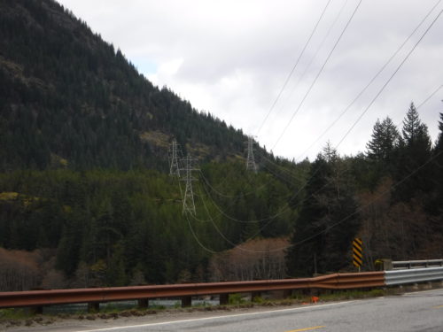
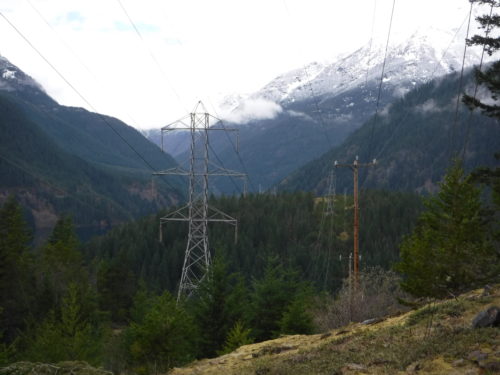
Around this point the powerlines have to start being creative. Instead of following the straight and orderly roads that so often habitat our urban areas, the powerlines in the park weave in and out of the forest. SR 20 travels under them numerous times. With each passing mile the locations become more remote and sparse.
Just a few miles past the town of Diablo there is a sign for the Environmental Learning Center. Turn left to traverse Diablo Dam (which if you have time is quite an impressive sight to see). Head just one mile more and park your vehicle. Now is where the real adventure starts.
Being a graduate student the journey up until this point was familiar to me. A few times a week I carpool from my residence at Blue House Farm in Marblemount to the Environmental Learning Center. Even the trail head, the Diablo Lake trail, was one I had taken countless Mountain School students on. As the stress of the bumper to bumper traffic melted with each passing step, I headed straight through both trail intersections and headed due east.
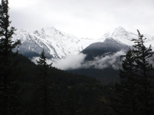
Even though I have been living at the Institute since July through the M.Ed. graduate program, never had I hiked this beautiful trail. Quickly I was taken away by the grouse, Douglas Fir and mushrooms that joined me. Even though it was not a particularly clear day, Pyramid and Colonial mountains still were watching over me on my search for the powerlines’ beginning.
Gradually over the journey east the path of the powerlines’ and road diverged. At this point the Diablo Lake trial had whole sections where I could not see any sign of the electron highways. Up and up I went, past fallen trees and rockly slopes. I started to gain so much elevation that subalpine firs started to appear!
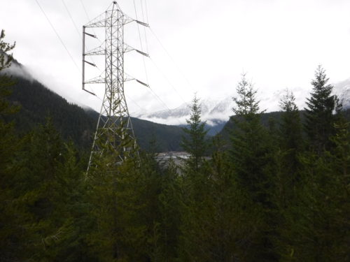
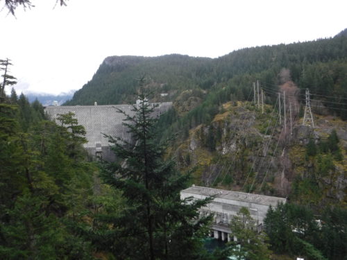
Just over 3.5 miles into trek, I came upon a sign that read “Outlook, 150 feet.” With heart racing I bounded to find the end of my journey: the Ross Lake Powerhouse.
Located on the northern most part of Diablo Lake, water traveling from Ross Lake travels through the turbines in the Ross Lake Powerhouse creating electricity. This transferred power then starts its trek through the artificial structures that so frequently habit our landscapes.
This is the largest part of the Skagit River Hydroelectric Project, being run by Seattle City Light. Ross Dam alone creates 610,120,000 KWh per year!
The next time I’m stuck in traffic on I-5, instead of pondering questions, I’ll have the adventures of this trip to occupy my time!