In my backyard…
As winter comes to an end and we transition into the spring and summer months, something really exciting happens. I’m not talking about plants flowering and birds singing and the sun coming out, although all of those things are definitely exciting. No, I’m talking about the spring opening of Highway 20.
Also known as the North Cascades Highway, this road is our outlet to civilization. At its highest point (Washington Pass) the highway rises to an elevation of over 5,000 feet, so it tends to build up quite a bit of snow. In the fall, snowplows clear the highway until there’s too much snow or too great of an avalanche danger for it to be safe. Generally, Highway 20 is closed from late November through mid-April or May.

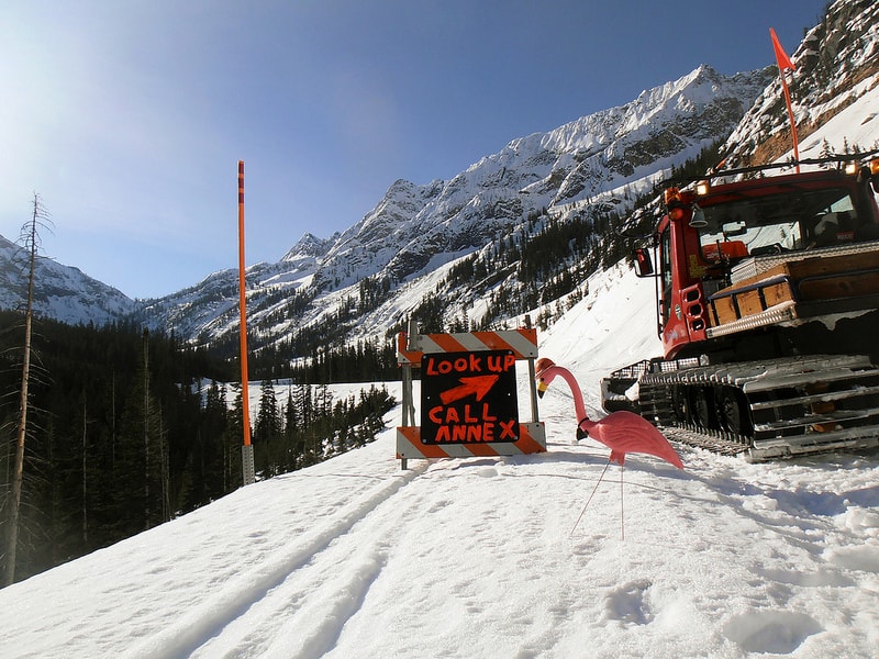
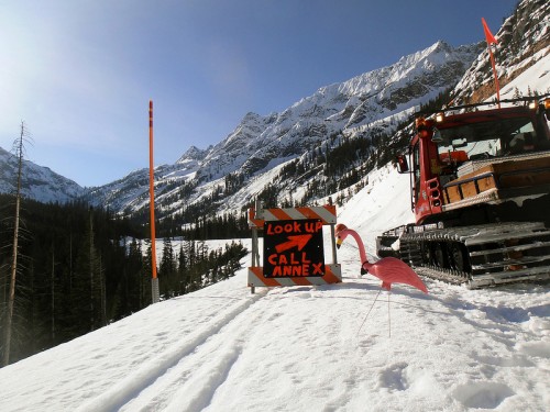 (above two photos) Floyd the Flamingo hanging out at Washington Pass and under Liberty Bell. Floyd sits in avalanche zones to warn the highway crew that they need to be extra cautious
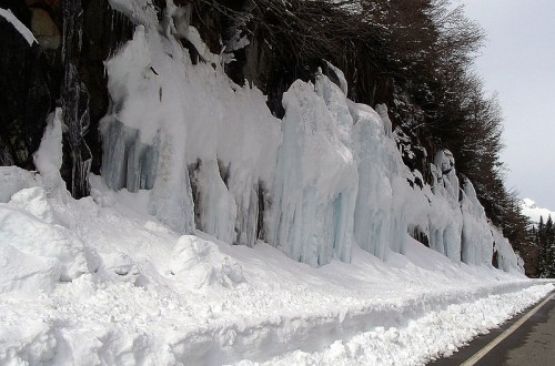 A wall of ice alongside the highway

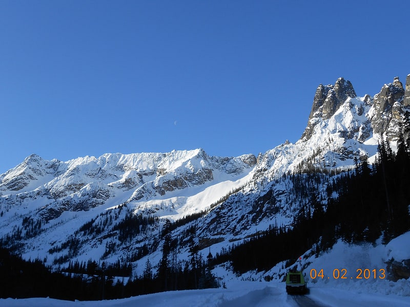
 Looking up at part of the Liberty Bell group
The North Cascades Highway first opened in September of 1972, just four years after the creation of North Cascades National Park. It’s the quickest and most direct route from the west side of the state to the Methow Valley. From the Learning Center it takes about the same amount of time to go west to Sedro-Woolley or east to Winthrop. During the rainy westside spring people often head east to enjoy the almost desert-like sun of Winthrop, Twisp, and Mazama. There’s also mountain biking and climbing and really good cinnamon rolls.
The North Cascades Environmental Learning Center sits just seven miles west of this highway closure and as the last stop at the end of the road, we don’t see a lot of cars for those six months that the road is closed. The winter is so quiet up here and almost every car you see is someone you work with or someone who works for Seattle City Light or the National Park Service. It’s great. It’s like the road belongs to us. People go past the gate to ski on the road and we’ve taken Mountain School students up there to go sledding on the rare occasion that we have a winter Mountain School session.
The highway crew starts clearing the road from both the eastside and westside closure gates, eventually meeting in the middle. Some years they’ve been met with 75 feet of snow on the road under Liberty Bell or had to wait out avalanche after avalanche, re-clearing sections of the road two or three times. As the pavement begins to show people take their bicycles or their rollerblades or their running shoes past the gate to enjoy our last bit of quiet and solitude before the excitement of summer.
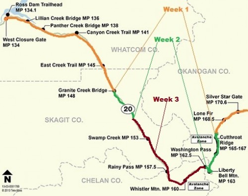 This map shows the progress that the snowplows made during each of the three weeks that it took for the WSDOT to clear the North Cascades Highway

This year the highway opened almost a month earlier than last year, and over a month earlier than the year before that. You can find a list of all the opening and closing dates since the road first opened on the WSDOT website.
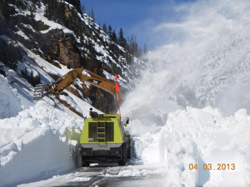
Leading photo of snow being cleared under the Liberty Bell avalanche chute. All photos courtesy of WSDOT 2013 spring opening flickr.
Ryan Weisberg is a graduate student in North Cascades Institute and Western Washington University’s M.Ed. program. Ryan grew up here in Washington, exploring the natural areas around Bellingham and in the Cascades. Ryan is the Chattermarks editor this year during their residency at the North Cascades Environmental Learning Center.