


In the Range of Fire & Ice: Peopling the Passes
I had long heard of the legendary beauty of Cascade Pass when Marjorie and I finally had the opportunity to hike up to it in September 2022, on a two-night backpack trip. The trail in North Cascades National Park starts at the end of a twenty-three-mile dirt-and-paved road that parallels the Cascade River east from Marblemount, Washington, about thirty miles south of Canada. We began our hike in a steep-sided valley dotted with perched ice patches and rimmed by a cockscomb of rocky peaks. Thirty or so switchbacks took us 1,400 feet up through Douglas-firs, Alaska yellow cedars, and mountain hemlocks and brought us to a level where we could contour gently up through debris slopes and vegetated hillsides to reach the pass at 5,398 feet.
There we found an unexpected site: three NPS rangers dressed in bright-red jackets. They were waiting for a helicopter. No one was injured, the standard reason to wait for a helicopter in a national park. Instead, the helicopter was coming for a far more mundane reason, ferrying two 50-gallon metal drums, a shovel, and a sledgehammer for the once-every-few-years emptying of the pit toilet. Not everyone gets to experience such a changing of the guard.
Wide open and level, the meadow at the pass had a ground cover of heather, huckleberry, sedges, and partridgefoot and islands of mountain hemlock and subalpine fir. To the north, the Sahale Arm—the broad shoulder of Sahale Mountain—extended up to ice and rock. To the south, the fractured, rocky summits of the Triplets, Mixup Peak, and more ice. East lay Pelton Creek, disappearing down a bend in a rocky valley toward Stehekin and Lake Chelan. To the west, rising behind the valley we had ascended, stood the great massif of Eldorado Peak, skirted by the Eldorado and Inspiration Glaciers. Unfortunately, we had arrived only days after fires had started to cloak the air. It was far cleaner than it had been in Seattle (which for a short time had the dirtiest air of any large city in the world), but the peaks lacked their alpine crystallinity. Instead, they were gauzy, the light flat and sickly tinted.
Now that we knew the toilets would soon be clean, we ate our lunch on a rock platform built to protect the fragile ecosystem. In the unregulated camping era, before the creation of North Cascades National Park in 1969, more than one hundred people used to camp nightly in the meadows. Soon after the creation of the park, camping became restricted to designated reservation-only sites in order to protect plants and animals.

Descending the east side of the pass after lunch, we were soon squeaked at by pikas, who had also been active on the other side of the pass. Both areas are pika utopias, with labyrinthian rock cavities for nesting and caching and widespread tufts of vegetation and nearby meadows for food. Whereas our previous pika-less experience at Wind Mountain had been damp and misty, the weather was warm and sunny, and the pikas were out doing what makes them so loved: eeenk-ing and looking cute, perched atop rocks, observing their domain, and in some cases sitting next to their also-cute peppercorn-like scat. One aspect of pikas I like, in contrast to chipmunks and ground squirrels, who often beg for and steal food, is that the more dignified pikas usually vanish like liquid into their lithologic homes when disturbed by people. I know that’s an anthropocentric view, but I respect pikas for their ability to disdain us and remain true to their nature.
For our first night, we camped on the east side of the pass, down in the trees of Pelton Basin. It was an official NPS camp, one of the designated locations where we could overnight legally along trail corridors in the park. Because of bears, one of whom had recently deposited a seedy purplish turdiform splat in the middle of a campsite path, we stored our food and any other human-smelling products in a bear-proof metal box and cooked our meals in a designated area, isolated from the tent platforms. We later saw a black bear a few hundred feet from the camp.
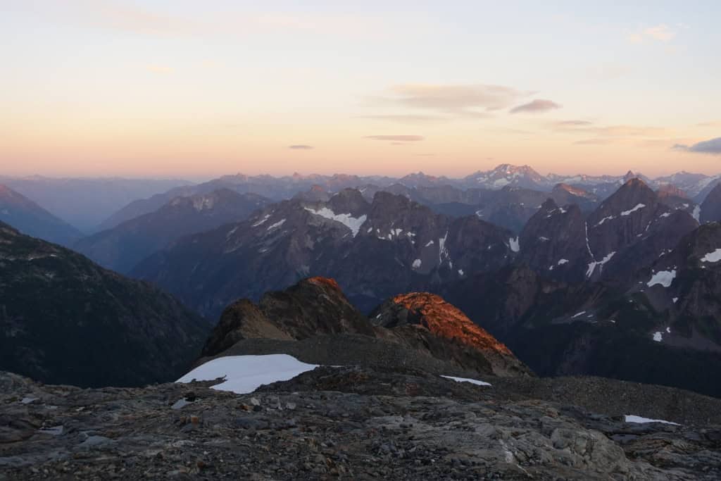
Night two found us at another designated NPS campsite, on Sahale Arm, a little over two miles north and two thousand feet higher than the pass. Unlike the previous night, which had been cool and mostly clear—the starry night had brightened my midnight constitutional—a series of rain, wind, and thunder cells cuffed our tent, well above tree line and only lightly protected by a wall of stacked boulders. We took advantage of the calm between cells to cook, pump water, pee, and reanchor our tent to the surrounding boulders. When the weather calmed after four or five hours of pounding, it was quiet enough to hear rockfalls crashing off the nearby walls. Since we were on an isolated mound, we weren’t worried about the rocks.
The view from Sahale the next morning was a stunning tapestry of jagged peaks, a cirque-bound mountain lake, and glaciers, the view unimpeded by trees. But I was most thrilled by the cloud rivers. From our high-elevation perch, we watched clouds that had streamed up the Cascade River valley and found the low gap at Cascade Pass. The day before, the cloud river initially couldn’t crest the gap and looked like a giant wave, just breaking in a few places across the divide. Then the wind shifted, or the pressure changed, and the clouds broke through, shooting misty currents to the east. In the early morning, the clouds had retreated, eddying well below the peaks, some of which just pierced the white to form sky islands. But now, as we descended, the cloud layer thickened and, once again, thin, vaporous streams burst through Cascade Pass, still one thousand feet below us.
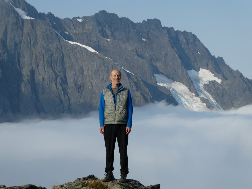
Just as the weather systems here follow the topography, I wonder if people in turn followed the clouds. Had early visitors trailed the diaphanous rivers up to the relatively low-elevation Cascade Pass to traverse across the North Cascades? We know from tools and other implements found at the pass that the first people at the gap arrived ten thousand years ago. I can easily imagine that people who relied on paying attention to environmental conditions for their survival would have understood that the streaming clouds probably indicated a low divide. They would have been further informed by the westward-flowing Cascade River, a source of water and salmon as well as other plants and animals they might desire.
People appear to have continued to visit Cascade Pass regularly, even returning after volcanic debris rained from above, burying their camp, cook, and tool-working site. In doing so, the countless generations of mountain travelers left behind a detailed view of how people used the subalpine and alpine zones of the Cascades. They were not alone: Cascade Pass is one of many passes that show how these low divides facilitated access into the mountains and their resources, and across to other resources and other people.
Excerpted from In the Range of Fire & Ice: A Human and Natural History of Washington’s Cascades by David B. Williams (September 2026). Published by Mountaineers Books. Reprinted with permission. All rights reserved.
Book links: