

The North Cascade Glacier Climate Project: Observing Glacier Change with Art and Science Since 1984
Glaciers have shaped the landscape of the Pacific Northwest and continue to provide critical water resources each summer. They shape our mountains, create lake basins; provide freshwater that sustains ecosystems, aquatic, and human life. When we head into the mountains for adventure the glaciers have helped create the environment we are in.
To better understand the rate of glacier loss and its impact on our region’s watersheds, I founded the North Cascade Glacier Climate Project (NCGCP) and led our first field season in 1984. The project’s goal was ambitious: to document the response of glaciers to climate change across the North Cascade Range for 50 years. The North Cascade Institute was founded shortly thereafter in 1986 with a goal of connecting people, nature and community through science, art, literature and the hands-on study of the natural and cultural history of the Pacific Northwest.
To foster connection with the North Cascades natural environment we backpack to every glacier, using no helicopter support, and leave no equipment in place. By 2005 it was evident that the profound changes that we were observing could be communicated with science information alone.We evolved into a glacier science and art expedition team. Incorporating artists was an unusual approach for science programs at the time, that has now become a desired approach. In recent years we have invited a painters, fiber artists, illustrators, writers, printmakers, photographers, and even a cake artist to join us. The result has been a series of exhibits “Shaped By Ice” that has leaned into the synergy of art and science to deepen our connection with the public intellectually and emotionally to glacier change.
In 2026 we embark on our 43rd summer of observations after a mild winter with limited snowpack and a warm spring leading to a snow cover declining to mid-summer levels by early June.
Measuring Glacier Change
Mass balance is the difference between “accumulation” (the amount of snow and ice added to the glacier each year) and “ablation” (the amount of snow and ice lost on the glacier each year). When ablation consistently exceeds accumulation, the glacier shrinks. We measure annual mass balance which is noted as the most sensitive climate variable for glaciers.
To determine mass balance we measure snow depth across the glacier using either a steel probe that can be driven through the snowpack or measuring the annual snow layer on the vertical wall of a crevasse. We observe ablation (melt) by observing the rate of snow depth loss using stakes emplaced for a brief period and observing the migration of the snow line. From 1984-2013 glaciers lost mass (avergae thinning) at a rate of 0.4 m/year. From 2014-2025 glaciers have lost mass at a rate of 1.5 m/year. Given that the average glacier was 50-60 m thick in 1984. The loss of 25-30 m represents a 40-50% loss of glacier volume.
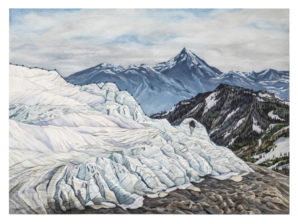
Several glaciers we measured mass balance on annually have disappeared including Ice Worm (2023), Lewis (1993) and Spider Glacier (2005).
In 1984 and 1985 we visited a network of 47 glaciers that we planned to return to every five years to understand how fast they were expanding or shrinking. Recognize that in the 1970s most large North Cascade glaciers were advancing, including all major glaciers on Mount Baker. In 1984 three of the glaciers were still advancing. By 1993 all 47 glaciers were retreating. In 2025, 12 of the 47 glaciers no longer exist.
The NCGCP annually measures three glaciers on Mount Baker (Easton, Rainbow, and Sholes), and periodically measure five others (Deming, Boulder, Coleman, Mazama, and Squak). By 2025, the average retreat of the eight glaciers since 1984 was 710 meters. From 1984 to 2025, the area of Mount Baker glaciers declined by 20-25% and experienced 24-27 meters of glacier thinning. In turn, glacier velocity (or, the rate at which these glaciers move, indicating the decline in mass balance) has declined, as has crevassing. The thinning also reveals new bedrock even high on the mountain.
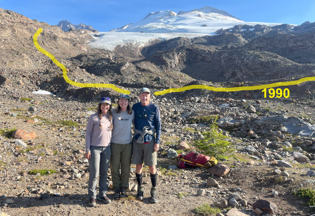
The result is a North Cascade Range with less glacier cover and more lose rock on the newly deglaciated terrain. There is also an impact on our glacier fed alpine rivers. The combination of glacier loss and streamflow changes is best illustrated in the Skykomish River Basin.
Skykomish Valley
Glaciers play an important role for rivers by buffering low flow periods and regulating stream temperatures during late summer. Without glaciers, the late-summer water supply diminishes and stream temperatures rise, which can reduce water quality and create unsuitable habitat for aquatic life. In the mid 1980s NCGCP identified nine glaciers in the Skykomish River basin that had active crevassing, an indication of thick and healthy ice accumulation, and sufficient area to be classified as a glacier. Between 2005 to 2023, six of these glaciers disappeared.
Two of the three glaciers that remain – the Lynch and Columbia Glaciers – now comprise 88% of the basin’s glaciated area. From 1984 to 2013, the mean annual mass balance on the Lynch and Columbia Glaciers was –0.38 meters per year (meaning, on average, they lost 0.38 meters per year). From 2014 to 2025, the mean annual mass balance decreased to –1.55 meters per year. The basin’s third glacier, Foss Glacier, has lost 85% of its area since 1958 and has almost disappeared, with 2026 being the likely year of its loss.
The basin is on a trajectory to lose all its remaining glaciers in the next two to three decades. This will complete the transition from a glaciated to an unglaciated watershed, with no capacity to restore any of the glaciers in the foreseeable future.
In the Skykomish River, ongoing glacier loss has resulted in lower late-summer streamflow and warmer stream temperatures. Since 1986, there have been 15 separate years when streamflow in the Skykomish River was significantly low (below 14 cubic meters per second) for 10 consecutive days, and since 2008, the river has repeatedly exceeded its maximum temperature threshold of 16oC (meaning that, under the Clean Water Act, the river violated water quality standards and was deemed “impaired”).
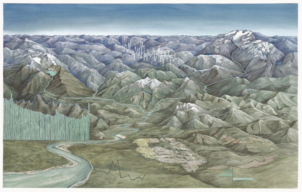
From the Glaciers to the Sea: this painting tells the story of this watershed fed by North Cascade glaciers that flow out into the Puget Sound. The snowpack and glaciers in the mountains in this region provide crucial meltwater to river systems, many of which connect critically to the ocean. Columbia Glacier is seen on the left of the painting, with the beautiful Blanca Lake beneath. This is one of three glaciers remaining in this region, the other five have recently disappeared. On the right side is the Alpine Lakes Wilderness, three of the nine glaciers in this complex remain. Most recently lost was the Iceworm Glacier, in 2023.
The large bar graph in this piece shows Skykomish River discharge (the volume of water) from mid July to late September in 2023. The decrease in water over the dry, hot summer period is evident. The line graph that makes up the mountain above the bars shows the temperature of the river at this same time, highlighting heat wave events. When the temperature spikes, and when the river levels drop, a critical threshold is reached for salmon and other species. This highlights the importance of glaciers in acting as a buffer during drought and heat events.
The Skykomish River is a tributary of the Snohomish River, where efforts are being made by the Stillaguamish Tribe to improve conditions for salmon. These important efforts may be significantly offset by continued glacier loss.
Looking ahead
Across the North Cascade Range, we’ve witnessed a 35-50% loss of ice in the past decade, translating to a rate of 1.5 meters of ice thickness lost per year. For many of the relatively small alpine glaciers in the North Cascades, this rate of loss has resulted in extinction.
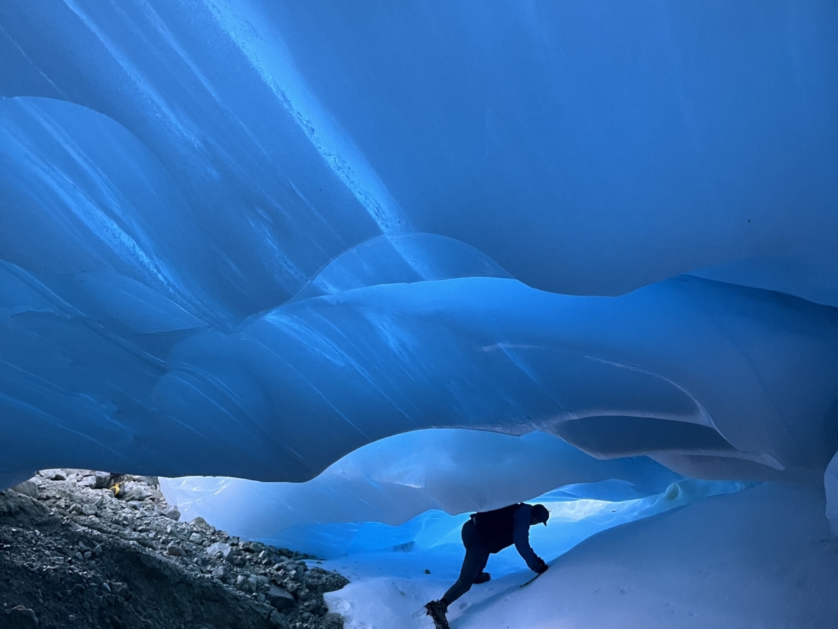
In addition to environmental consequences, glacier loss significantly impacts our recreational experiences by altering climbing routes, increasing rockfall risk in newly deglaciated areas, and creating unstable ice caves. No longer can you stand atop a Cascade peak in late summer and look over a range of glacier-clad summits.
At the current rate of loss, it’s uncertain whether fifty years from now any glaciers will remain. The possibility depends on the choices we make and the evolution of our energy production and consumption.
You can help protect our glaciers by:
Contributing to the research. Share your observations with the North Cascade Glacier Climate Project by emailing mspelto@nichols.edu or tagging us on Instagram (@mspelto and @jillpelto). We cannot reach all of the glaciers we would like observations of.
Reduce Footprint: Identify how you can reduce your carbon footprint and implement those changes that in particular add net value now.
Participating in local climate advocacy. Work proactively with organizations that amplify your voice in asking lawmakers to support policies that protect our cherished landscapes, and educate your community about the impact of sustainable lifestyle choices on our glaciers.